


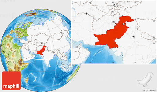
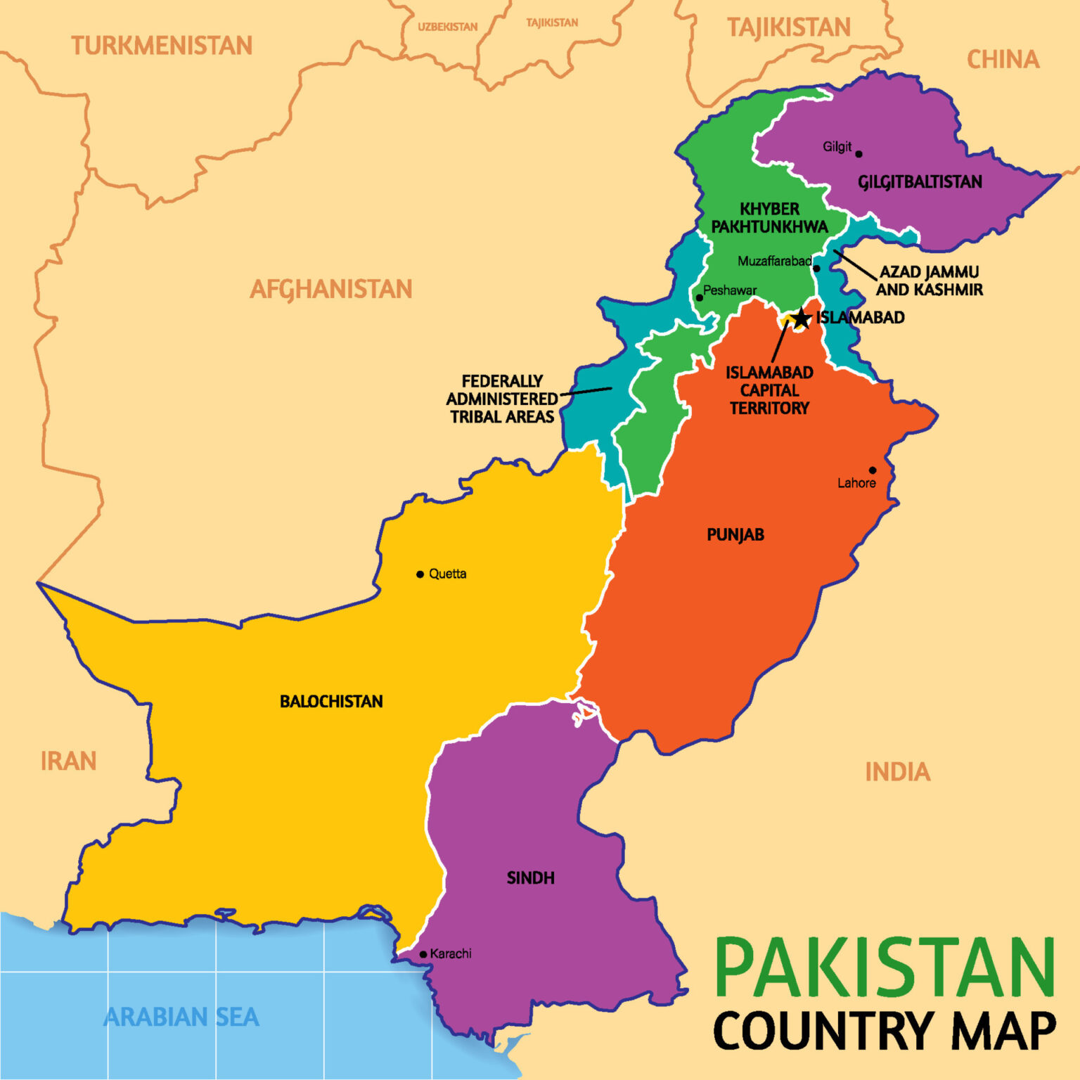
The Location of Pakistan is situated in South Asia, bordered by India to the east, Afghanistan and Iran to the west, China to the north, and the Arabian Sea to the south. Its geographical coordinates range approximately from 24 to 37 degrees north latitude and 60 to 77 degrees east longitude. The country’s location plays a significant role in regional politics, trade, and cultural exchange.
Pakistan is located in the western part of South Asia. It extends from 23o 35’ to 37o 05’ N (Latitude). Proximity to the tropic of cancer (23o 30’ N) dose not allow the rays of the sun to become very slanting. Therefore, Pakistan records high temperatures in summer, and winters are not very severe. However, at higher elevations, very low temperatures are recorded.
Pakistan extends from 60o 50’ to 77o 50’ E (Longitude). Longitudinal extension is not much: the standard time of Pakistan is five hours ahead of Greenwich Mean Time. Comparatively, USA, with a large longitudinal extension, has a number of time zones.
Pakistan is surrounded by land on three sides, east, west and north. The Arabian Sea, which is a part of the Indian Ocean, lies to its south. Pakistan, therefore, has full access to the ocean routes, particularly the Asian-Mediterranean Rout, which connects Pakistan to Japan, china and other East Asian countries, South East Asia, South Asia, south-Western Asia, North and North-East Africa, Europe and North America.
The Arabian Sea has moderating effects on the temperature of the costal of Pakistan. Consequently, the coastal areas do not experience severe summers or severe winters in comparison to the interior of the country.
A Comprehensive Guide
Solar Generators for RVs: The Must-Have Accessory for Camping Enthusiasts
Get Off-Grid with the Best Solar Generator for Your RV
solar generator with 30 amp rv outlet solar generator with 30 amp rv outlet .
Expert Recommendations
Stay Prepared for Emergencies with the Best Solar Generator for Home Backup
solar generator for home backup http://olargener-ackup.com/ .